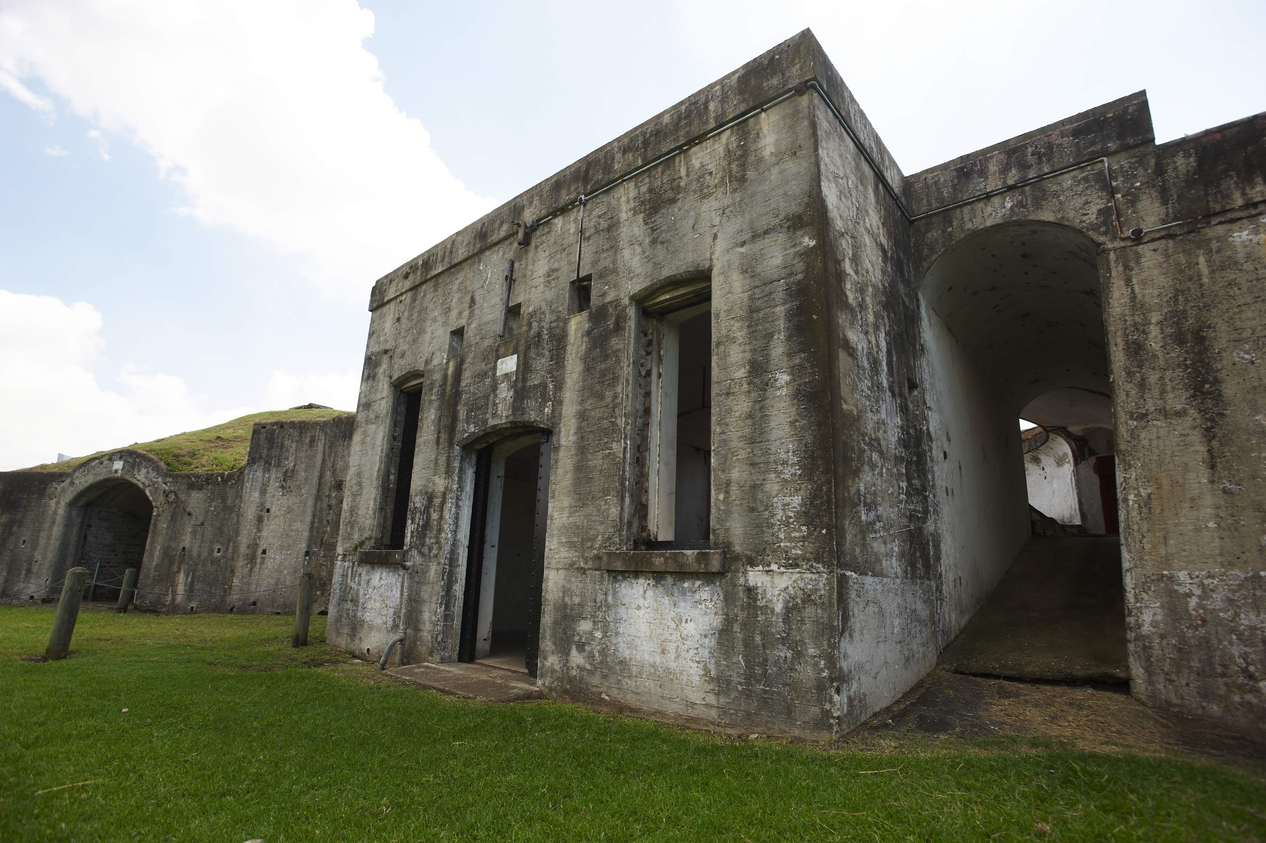
19th century Brisbane River defences at Fort Lytton, Brisbane
Today marks the start of National Heritage Week – a time to celebrate Australia’s unique and fascinating heritage. We are kicking off the festivities by presenting new 3D data from Fort Lytton, one of Queensland’s most significant cultural sites. This pentagonal fortress was built in 1881 to protect Brisbane from potential invasion up until the end of World War II.
Working with the researchers from University of Queensland’s School of Architecture, scientists from our Autonomous Systems Lab are using our Zebedee scanner to capture a 3D point cloud of the national park.
Zebedee is a mobile, handheld 3D laser scanner that swings back and forth on a spring to capture millions of detailed measurements. It gives researchers the ability to reliably map an environment in 3D simply by walking through it.
“This technology is ideal for cultural heritage mapping, which is usually very time consuming and labour intensive. It can often take a whole research team a number weeks or even months to map a site with the accuracy and detail of what we can produce in a few hours,” said Dr Jonathan Roberts, Director of CSIRO’s Autonomous Systems Lab.

“Zebedee has allowed us to capture a detailed record of several key cultural heritage sites ranging from those which are fragile and at risk of damage from natural disasters, to those which are remote and difficult to get to,” said Kelly Greenop, from the School of Architecture at The University of Queensland.
“We’re looking to use these maps in the future to create an archive of rich data about cultural heritage sites, which will allow us to analyse them without costly and time consuming hand measuring. From this, we have already analysed important aspects of Australian history. For example, the detailed map of Peel Island’s many small buildings allowed us to analyse architecture used to racially segregate people within the leper colony. The point cloud data clearly depicts how cramped and crowded the living quarters for Indigenous people were, when compared to the non-Indigenous people who lived in their own huts with scenic verandas,” she said.
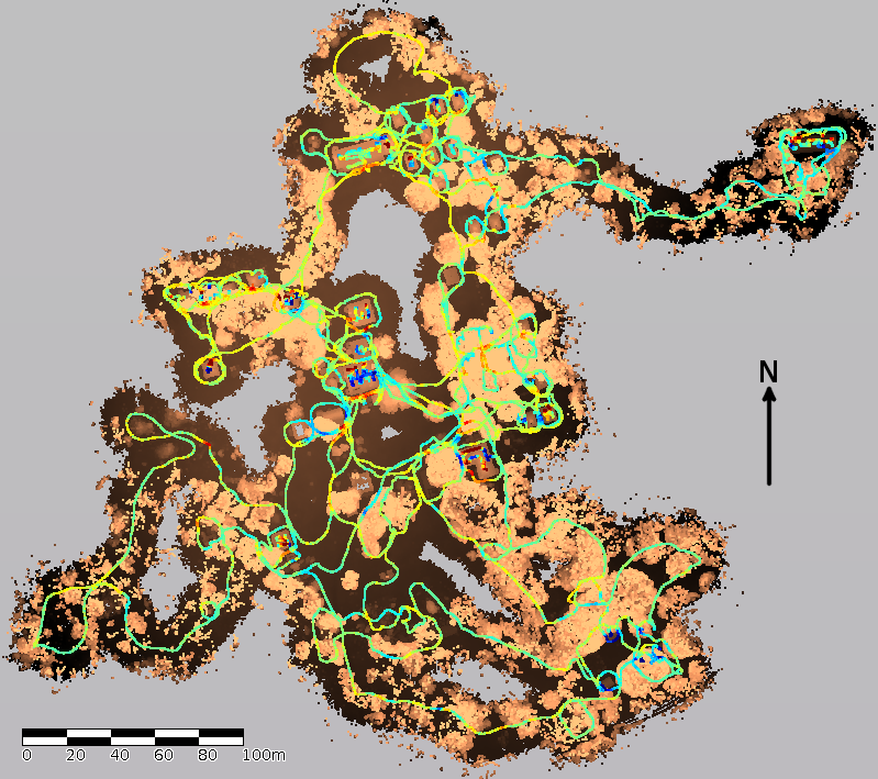
A still image of the 3D data captured from Peel Island
Not only can this tool help us to understand the past, but it can also measure change over time.
“What’s exciting about this project is that we can overlay historic data with current data. This means we can view the site over a period of time, which is something that we’ve never been able to do before,” says Queensland historian Brian Rough.
This means that in the future anyone with internet access could soon discover the secrets of the Fort, along with many other fragile or remote environments, from the comfort of their own home.
Check out this video for more information on the project:
And why not join in the celebrations this week to commemorate the remarkable sites that helped shape our nation.
Media: Dan Chamberlain. P: +61 2 9372 4491. M: 0477 708 849. Email: daniel.chamberlain@csiro.au

1st May 2013 at 4:10 pm
How much are these marvellous inventions? Perfect for a TimeTeam fan!
2nd May 2013 at 8:58 am
Hi Ursula. The device is being distributed by 3D Laser Mapping in the UK (though they also have offices in Australia, the US, and elsewhere). We can’t really post the price publicly since that is determined by the company, and they themselves don’t post it (plus it might vary in different markets or it could be changed at their discretion). If you’re interested in purchasing ZEB1 (which is the product name), you can email info@3dlasermapping.com or check out this website: http://3dlasermapping.com/index.php/indoorintroduction