
By Adam Harper
Deep in the woods of regional Victoria, you could be forgiven for thinking you’d walked onto the set of Star Wars as the night sky is filled with lasers being fired into the treetops. Pew pew!
But don’t worry, these lasers aren’t harmful and sadly it’s not a rave. In fact under normal conditions the lasers can’t even be seen.
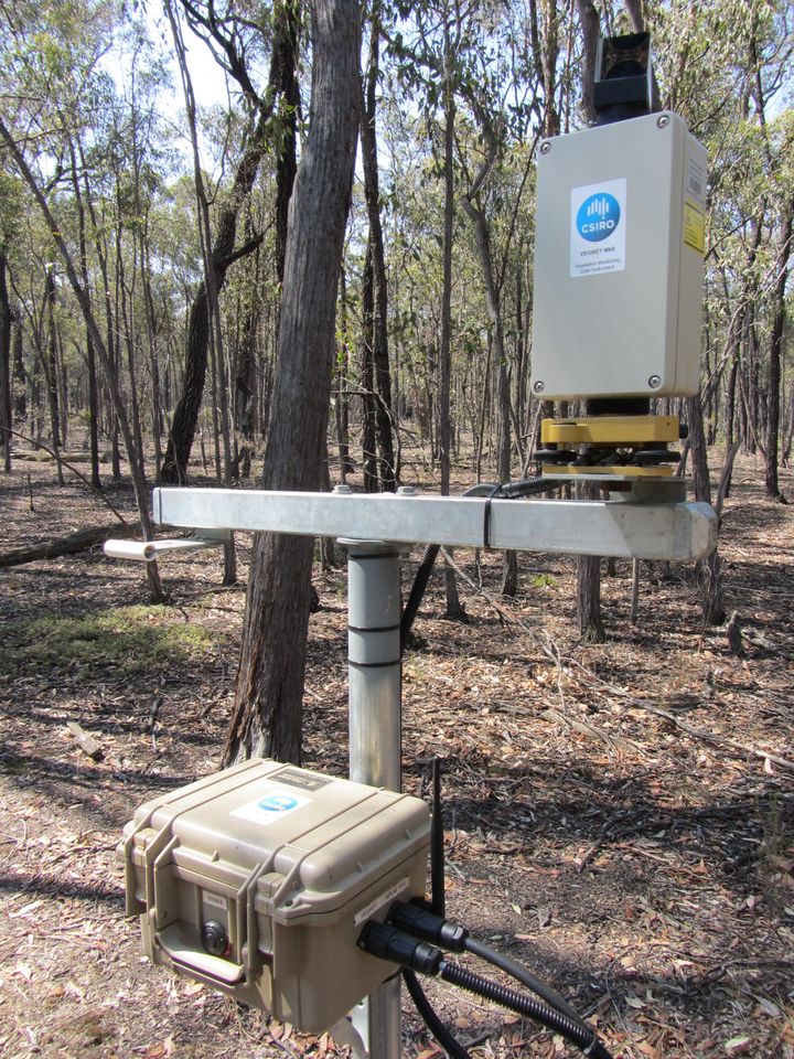
The scanner (top) records the information to the data logger (below) before sending the information wirelessly.
What these lasers are doing is setting the global standard in forest vegetation monitoring. They’re called VegNET, world first scanners that have been developed by our Sustainable Agriculture Flagship to measure the change in forest canopies over time.
“By comparing weather and soil information to changes in the forest canopy we can better understand how things like climate change will affect our forests,” said our research scientist, Dr Glenn Newnham.
Forests are the lungs of the earth, they provide us with our oxygen rich atmosphere, filter our waterways and provide shelter for our wildlife; land managers need to understand how best to protect them.
We have been working with the Department of Sustainability and Environment (DSE) in Victoria on the Victorian Forest Monitoring Program. This will see about 500 plots set up in forests across the state. If current trials are successful, VegNET technology may form an important part of forest monitoring programs in the future.
“The technology is an adaptation of a piece of equipment you can buy in the hardware store, the laser rangefinder. It measures the distance between two points and with a few modifications can be set to take measurements automatically,” Dr Newnham said.
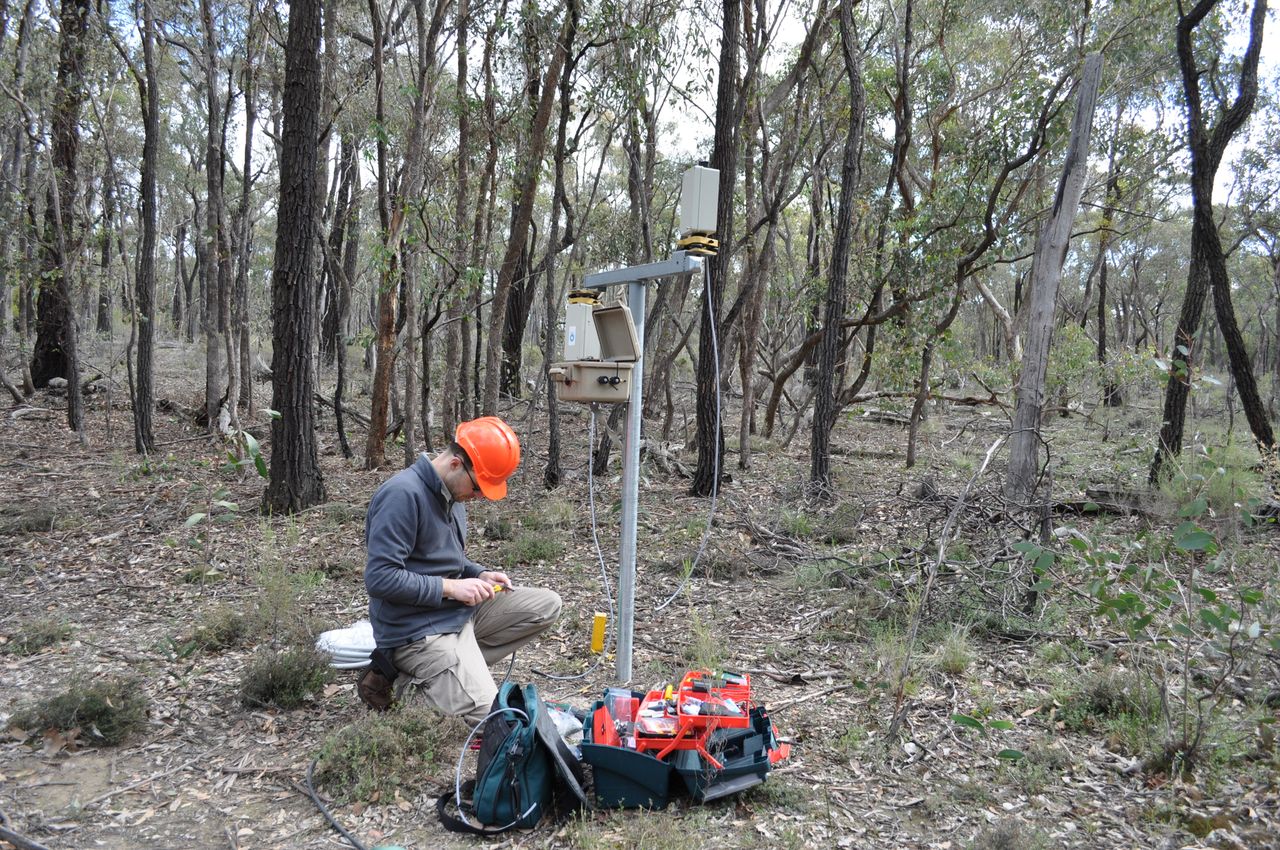
Late at night, when most of the state is sleeping, these scanners are waking up for work, which involves taking a 360 degree scan over about 40-minutes to record 1,000 measurements of the forest above. This information is sent wirelessly to a data logger and made available online for scientists to access and analyse. Over several years this will become an extremely valuable record of the state of Victoria’s forest environment.
The next step of the program is to calibrate the technology with satellite observations. This will allow the DSE to monitor forest health and condition on a large scale with great ease.
“Traditional methods of forest measurement are still used but some of these sites take hours to get to. This technology is helping to provide more information in less time and is setting world standards,” Dr Newnham said.
The other advantage of such rapid monitoring of forests is that it can alert land managers to issues such as pest and disease outbreaks which may have gone unnoticed for months otherwise.
To find out more about the VegNET technology, it’s creator Dr Darius Culvenor and the partnership with DSE Victoria, we have this video for you :
