For most of us, maps help us get from A to B. Our GPS finds the shortest route to a friend’s house. A state map shows the highway winding up the coast to our camping spot. The city guide shows our conference venue in the CBD.
But during disasters, like the Tasmanian bushfires last summer and the Queensland floods before that, maps have a whole different purpose. They show which towns are under threat or which roads might be used to bring in emergency supplies or which shopping centres might be too damaged to open.

Where do we go when disaster strikes? Image: State Farm.
When a natural disaster strikes, people in particular locations need help quickly. Once the immediate threat has passed, those people need assistance. The quicker this can be provided, the quicker people can get back on their feet and rebuild their communities. Luckily, the Department of Human Services (DHS) provides disaster recovery assistance during the floods, droughts, fires, cyclones and other natural disasters we face in Australia. Map-based information is critical to that response. That’s where ERIC comes in.
ERIC is a web based tool that we’ve developed in partnership with Human Services that generates emergency situation reports for the Department. It brings together information from a range of federal and state government agencies into one easy-to-use interface. Information such as weather warnings and fire details along with population statistics are overlaid on a zoomable web based map. Layer upon layer of information is instantly at hand to assist social services managers in making service delivery decisions.
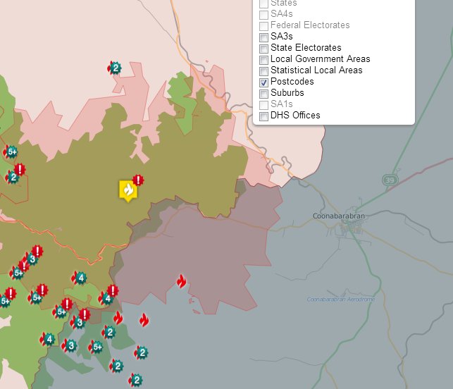
In a matter of minutes, ERIC can map out the hot spots and extent of a fire.
ERIC, the Emergency Response Intelligence Capability, streamlines the information gathering and integration process from hours down to minutes. By automating some of these manual tasks, the Department’s staff can ensure that resources are directed to areas where they’re the most required.
Robert Power, project leader and member of the Human Services Delivery Research Alliance, says ERIC makes use of new web based technologies and has allowed a step-change in the way the Department deals with emergencies. It improves emergency managers’ productivity and efficiency, directing resources where required.
“I’ve been impressed at how combining information and using some of the latest spatial technologies really adds value when responding to emergencies”, he said.
“It’s great to see how useful ERIC is. The whole is so much bigger than the sum of the parts.”
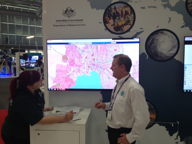
ERIC in action: DHS’s Lucy Tate and our own Charlie Hawkins showing off the technology at CeBIT.
This week, we’re displaying a prototype of ERIC as part of our display at CeBIT in Sydney. The model has been fine tuned by Human Services who’ve trialed it in a number of recent disasters. Our researchers and experts from the Department will be on hand to talk about it. So, using a good map, make a beeline to Darling Harbour if you’re in the area. And, if you can’t make it, stay at home and try ERIC from your desk.
Media: Dan Chamberlain. P: +61 2 9372 4491. M: 0477 708 849. Email: daniel.chamberlain@csiro.au
