Picture this. It’s a beautiful autumn day in Melbourne. You’re about to embark on a walking tour to discover some of the city’s finest architecture. My name is Carrie and I’ll be your tour guide.
We begin at one of the city’s more stately buildings – the Shrine of Remembrance. This grand temple-like structure was built back in 1926 and is located right next to the Botanic Gardens. It’s a focus for the city’s ANZAC Day ceremonies each year and in this ANZAC Centenary commemorating the start of WW1.
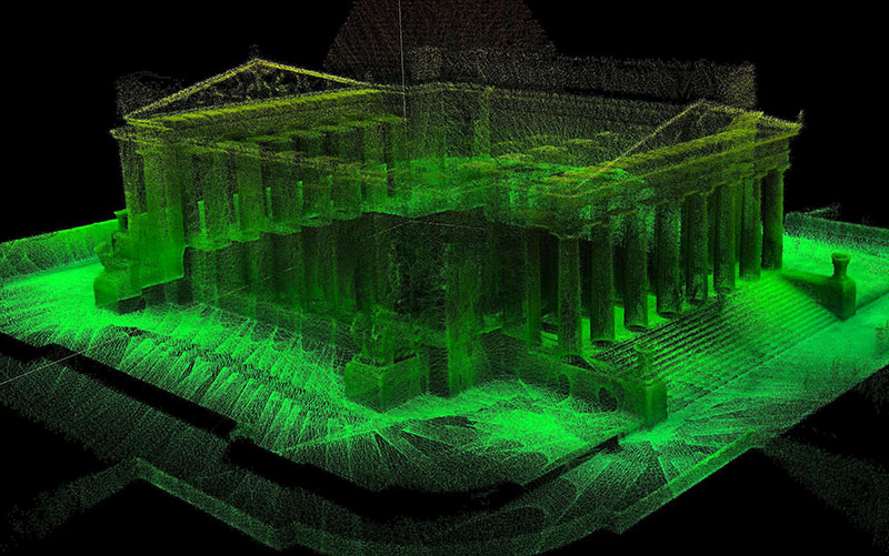
3D map of The Shrine of Remembrance, Melbourne
3D map of The Shrine of Remembrance, Melbourne
This month our scientists at CSIRO brought high tech to history by mapping the Shrine using a 3D laser scanner, preserving it digitally with a tool called Zebedee.
As you can see, it’s very timely. Major renovations at the Shrine are underway to get ready for commemorations of the Gallipoli landing’s 100th anniversary in 2015. It’s part of the $45M ‘Galleries of Remembrance’ project.
The Shrine joins a select group of heritage sites mapped in 3D by the Zebedee scanner, along with Brisbane’s Fort Lytton, and even the Leaning Tower of Pisa.
Now I personally get quite excited about architectural drawings, but these 3D maps add detailed information for building managers and heritage experts by measuring the actual built spaces. Zebedee technology offers a new way for recording some of our priceless treasures.
Let me show you one of the interior images of the Shrine. These amazing ‘point clouds’ are created by a handheld laser scanner bouncing on a spring as the user walks through corridors, up stairs and round about. As long as it takes to walk through the building is about how long it takes to make the map. You can watch it online afterwards.
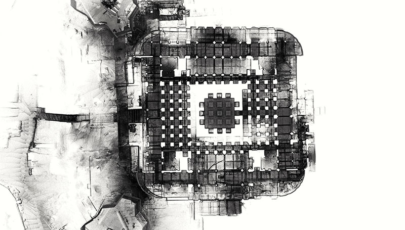
Aerial section view from 3D map of the Shrine's undercroft showing columns
Aerial section view from 3D map of the Shrine’s undercroft showing columns
Despite their almost X-ray look, Zebedee can’t see through walls as the laser bounces off solid surfaces. But when you put all the data in one place you get a sliceable, zoomable, turnable map with architectural details like stairs, columns, voids, ceilings all measured to the nearest centimetre. But . . . no roof! That’s because our scientists are developing a flying laser scanner that scans rooftops from the air. Secret attics may be secret no longer.
That concludes our tour for today. If you’d like to take home your very own Zebedee souvenir, head to our website.
