Ever wondered how hot your home gets in summer or how cold it is in winter? Think solar is a good idea but not quite sure if it would work on your roof? Wondering if it’s worth investing in a rainwater tank?
Now with a new interactive tool we helped develop called My Climate, residents of Melbourne’s City of Port Phillip can do their own internet-sleuthing to answer these questions. What’s more, this could kick-start a trend that would see residents around the country taking more responsibility for these types of decisions.
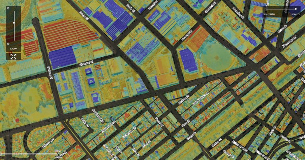
My Climate uses thermal mapping taken from aerial flyovers and seven temporary weather stations to show land surface temperatures, winter heat loss, rainfall and the solar potential of all buildings in the region.
My Climate displays heat loss from residential homes and can show heat loss during winter.
Working with the City of Port Phillip and Monash University, we originally developed My Climate to inform urban planning decisions. It didn’t take long to realise how useful the data would be to the whole community.
“With this data you can calculate the most appropriate solar system for your home, where it would best be located and how much it could potentially save you in electricity costs and Co2 emissions. You can also measure rainfall and calculate the cost of improving your ceiling insulation,” Port Phillip Mayor Amanda Stevens says.
“If thermal imaging shows your neighbour’s home is cooler than yours, it may mean they have better insulation, or cool air from their air-conditioner is leaking outside the home.
“This easy-to-use tool has the potential to add real value to people’s homes and on a larger scale can help tackle the impacts of climate change.”
Dr Mahesh Prakash and his group from our Digital Productivity Flagship helped develop the analytics and software component of the interactive tool. He says his team is now looking to expand My Climate to include other layers of information such as natural hazard hotspots and optimum tree coverage. He would also like to see it rolled out to other Councils.
Explore the My Climate tool on the City of Port Phillip website.


16th March 2015 at 1:59 pm
Well done the City of Port Phillip.
This seems to be a trial that should be extended very quickly into a nation-wide project.
Since it is done in part using local fly-overs, it would seem to be an excellent use for really good, GPS-controlled, drone quadcopters. Add to that the number of home owners who now have their own digital weather stations and the project could even be a local project, rather than mucking around with the vagaries of politicians.
28th March 2015 at 8:03 am
Thanks for your comments John.