Earlier this year one of Australia’s wartime mysteries was solved, when the team onboard Australia’s Marine National Facility research vessel, Southern Surveyor, discovered and mapped the wreckage of the MV Limerick, off the coast of Ballina in northern NSW.
The MV Limerick was sunk in 1943, and it has taken almost 70 years, and the opportunistic use of Australia’s Marine National Facility research vessel, Southern Surveyor, to identify the ship’s final location.
Limerick was one of the largest vessels sunk by Japanese submarines off Australia’s east coast from 1942 to 1943.
Confirming the wreck as MV Limerick was in the national interest. We were already in the area, we had the necessary technology and technical expertise and in the end it didn’t take long to create a 3-D image of the wreck.
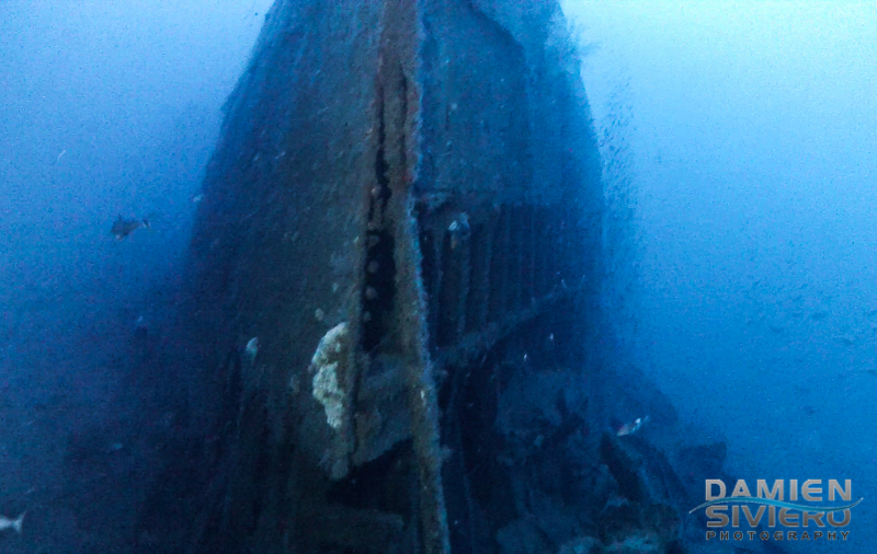
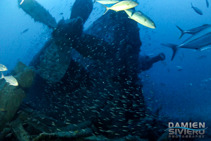
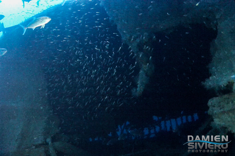
Now, a diver has plunged the 107 metres at the shipwreck site and captured the first haunting images.
You can read all about Damien Siviero’s dive here.

29th January 2021 at 12:46 pm
Ross I can share a little about the first dives on the Limerick
25th April 2020 at 9:22 am
My Uncle who I am named after was the third mate on the Limerick his name is John Edgar Willmott
27th January 2015 at 9:32 pm
Hi there
I am wanting to know where the wreck of the MV Limerick is off Ballina on the Nth Coast of NSW as a relative of mine was on it at some stage during WW2
If you could supply me with the GPS mark or points that would be much appreciated
Regards Ross
24th February 2015 at 12:49 pm
Hello Ross
Thanks for your email. You will need to contact the NSW Office of Environment and Heritage which now manages the site.
Cheers
Sarah