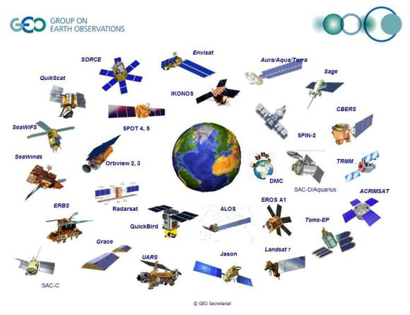
No doubt we’ve all seen stunning images of the planet we call home and thought ‘wow’. Orbiting earth at any one time are thousands of satellites. They may help in many different ways from helping your daughter call you from her holiday in Paris to assisting helicopter pilots communicate with each other.
Some satellites are up there to help us observe our earth. Our scientists are very fond of these satellites and are known to recount stories of what they were doing when a particular satellite was launched.
On 11 February 2013 (USA time), a satellite called Landsat 8 is being launched from California by NASA. This satellite is the eighth in a satellite legacy of more than 40 years observing and measuring the earth’s surface . If you want to find out more about what happened to earlier Landsat satellites (including the launch of number 1 in 1972 and the crash of 6 into the Pacific Ocean) then check out NASA’s website.

Landsat satellites provide unobstructed views of the earth giving us valuable information for monitoring land and coastal environments, forest monitoring, disaster impact assessments, water resources, and environmental health of a wide range of ecosystems.
Peter Caccetta, a research scientist based in Perth, has been working with Landsat data at CSIRO for more than 20 years. He began working with Landsat to monitor agricultural and forested areas.
“I wasn’t even old enough to go to school when the first Landsat satellite went up but thanks to the vision of US scientists in the 1960s, we have images of our earth over more than 40 years,” he said.
“Landsat data provided the first view of the landscape from space at a resolution relevant for those interested in property scale changes but also useful over very large geographic areas, for example the Australian continent.
“Landsat images provided the first view from space for farmers to see variation within their properties and how their farm sat within the broader catchments.
“We have a unique historical record of digital images of the Australian continent,” he said.
Landsat data has been applied across many environmental monitoring applications around the world (see the fantastic images of ‘fields of green’ in Saudi Arabia desert below) and has been used extensively by our scientists for studies where current and historical knowledge of the earth’s surface is required. For example, comparing an event we observe today to what has happened in the past.

One area of particular interest for CSIRO continues to be carbon accounting and the ongoing work to share lessons from Australia’s National Carbon Accounting System (NCAS) with other countries, for example with Indonesia through the Indonesia-Australia Forest Carbon Partnership.
Peter Caccetta was part of the Eureka Prize winning team (including people from the Department of Climate Change, Energy Efficiency, the Australian National University and many others) that developed the world-leading NCAS. This system is one of only a few operating in the world.
Australia’s NCAS currently uses data from Landsat satellites 1, 2, 3, 5 and 7 to estimate changes in the continent’s vegetation cover. These results are then combined with other sources of information and computer simulations to produce estimates of greenhouse gas emissions from different land management activities. With the launch of Landsat 8, this will help maintain the continuity and accuracy of our carbon accounting systems.
Sharing Peter’s enthusiasm for the launch of Landsat is Inge Jonckheere from the Food and Agriculture Organization of the United Nations. Inge works on the UN-REDD Programme, the UN answer to Reducing Emissions from Deforestation and Forest Degradation (REDD+) under the United Nations Framework Convention on Climate Change helping countries implement their national forest monitoring programs to get them ready to participate in REDD.
“We are very excited by the launch of Landsat 8 because it will provide continuous, easily available, openly accessible data to developing countries,” said Inge.
“This means it’s all freely available for developing countries and they do not need to depend on particular software or hardware,” she said.
With Australia signed on to the Kyoto Protocol, a key push for the Australian Government and indeed CSIRO’s research is to have consistent forest information and monitoring across the country so that we can measure and understand changes and emissions, and support carbon reporting activities around the world.
So really, the launch of another satellite may not seem like a big deal but the launch of Landsat 8 is a huge deal for thousands of scientists and indeed policy makers around the world waiting, with all fingers and toes crossed, to get new pictures of the world.
Watch live coverage of the launch of Landsat on NASA’s TV channel or check out the gorgeous animation of Landsat orbiting the earth.

