The group within CSIRO that will operate the sea floor mapping equipment on board RV Investigator are called the Geophysical Survey and Mapping Team.
In addition to their work on the new Marine National Facility research vessel, Investigator, they have recently acquired the EM2040c, which is a small, mobile, high resolution multibeam echo sounder, or a shallow water sonar.
The equipment is new to the team, and is part a suite of technology the team has available to Australian researchers for use in coastal research.
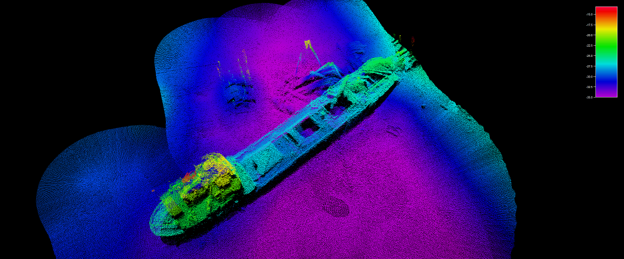
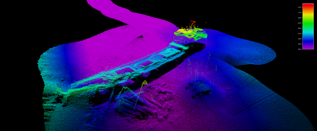
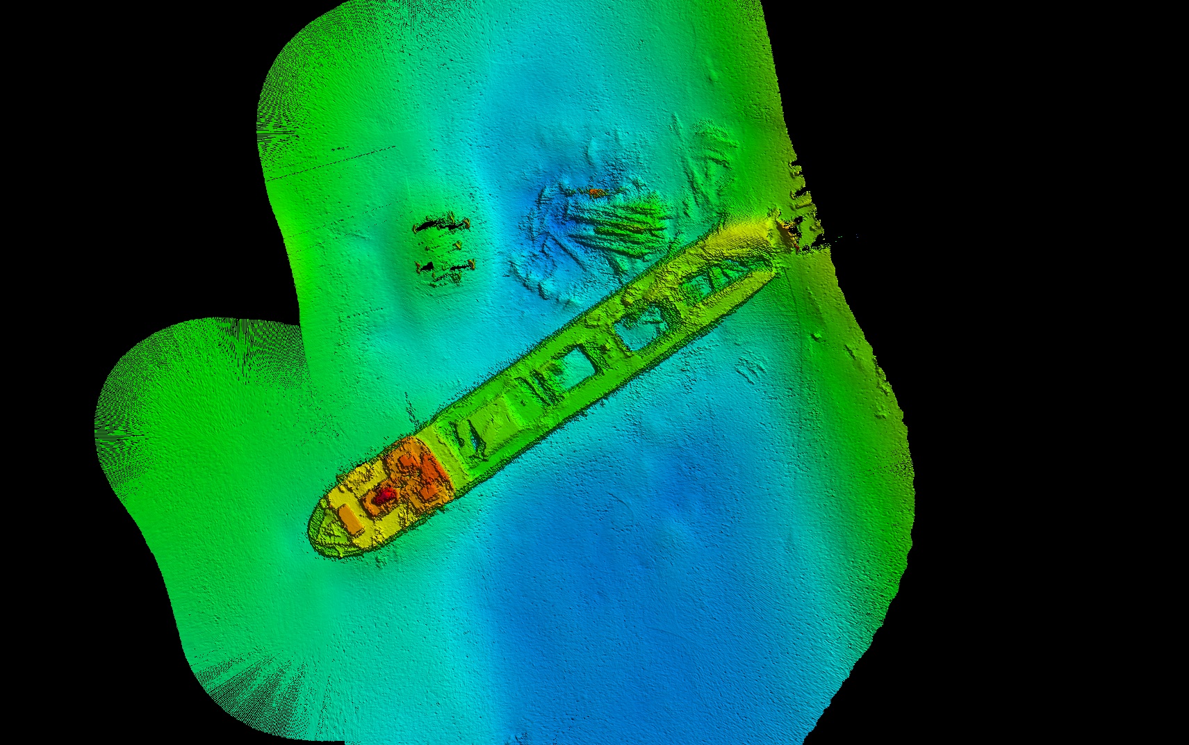
Matt Boyd and Stuart Edwards from the GSM Team and Andrew Pender from the Institute for Marine and Antarctic Studies went out in the IMAS vessel Morana to calibrate the EM2040c and mapped the shipwreck of the Lake Illawarra.
MV Lake Illawarra was a 135 metre long bulk carrier that is currently lying in 34 metres of water on the southern side of the Tasman Bridge, in the Derwent River in Hobart, Tasmania.