By Carrie Bengston
Our TV screens showed us the devastation caused in the US by Hurricane Sandy but what natural disasters might we face in Australia this summer? What ‘terrors’ will our ‘wide, brown land’ dish up?
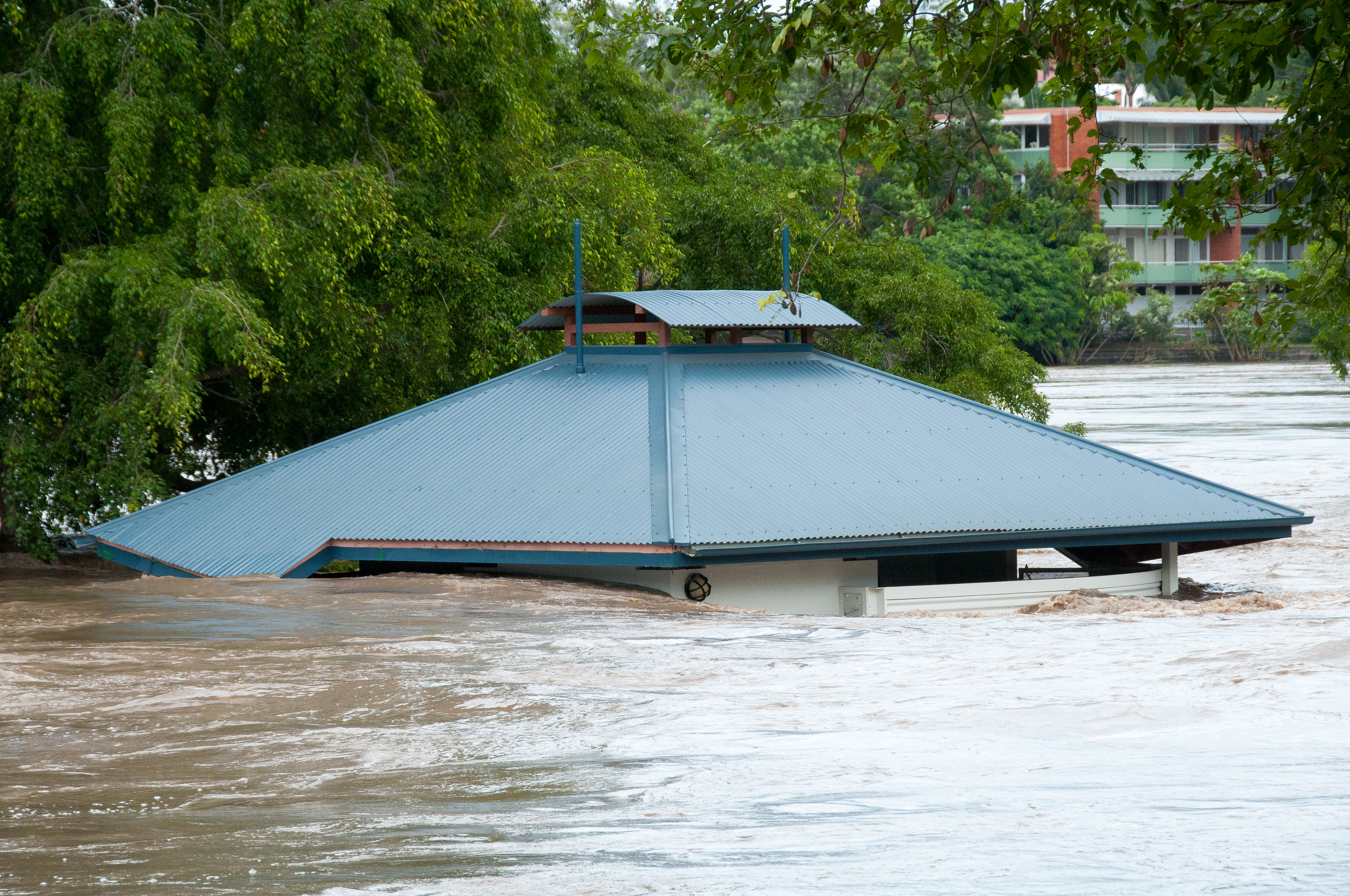
In summer 2010-11 it was the Queensland floods – a flash flood in Toowoomba, submerged Brisbane streets, and towns cut in two. The summer before it was the Black Saturday bushfires – destroyed homes and businesses, iconic forests reduced to cinders, and numerous human lives lost.
Flooded toilet block at Orleigh Park, West End, 13 Jan 2011. Photo by Glenn Walker.
And the summer of 2012-13 – what will that bring? Whatever it is, Australia’s emergency services and disaster managers will be getting ready.
While technology can’t prevent catastrophic events, a CSIRO report talks about how emerging technologies help emergency services better manage natural disasters and minimise effects on people, infrastructure and the environment. The All Hazards: Digital Technology & Services for Disaster Management report brings together for the first time an overview of our research in technologies for disaster planning, preparation, rescue and recovery.
Alan Dormer, Research Leader in Government and Commercial Services at CSIRO, said that in 2010, 385 natural disasters affected 217 million people worldwide and cost the global economy US$123.9 billion.
While CSIRO has been researching natural disasters such as bushfires and floods for many years, we’ve now set up a disaster management research team in our new Digital Productivity and Services Flagship. The team will focus on technologies for disaster management.
“Although we’ve got lots of pieces of the natural disaster research puzzle, we haven’t got all of them. We’d like to bring together CSIRO’s existing expertise and work with organisations like Geoscience Australia and the Bureau of Meteorology.”
“Of course all this technology won’t be able to stop natural disasters happening but it will provide ways to plan for and manage disasters more effectively and so reduce the human costs,” Alan said.
For some examples, there’s our realistic, maths-based fluids models of tsunamis and storm surges being used by coastal councils to predict flooding.
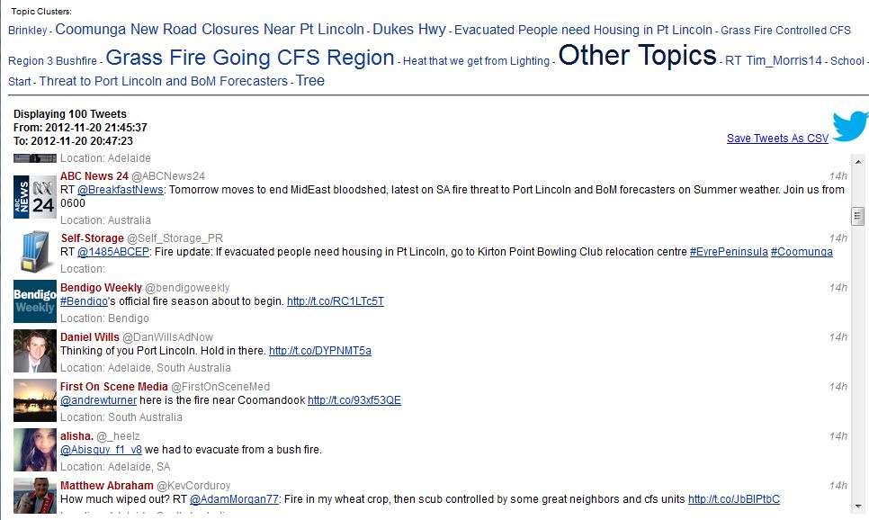
And because social media is changing how emergencies are reported, we’ve created software to give rescue services early warning of emerging situations by detecting mentions of disasters on Twitter. For example you can see in the picture a selection of tweets about fires near Port Lincoln this week.
Emergency Situation Awareness software can find clusters of posts on Twitter that relate to an emergency.
Not only that, we’re using advances in spatial data technologies and analytics to improve the ability of governments here and overseas to locate vulnerable communities so they can get aid to them quicker.
Phew! Now we can relax. Photo “La buena vita” by Serge Melki on Flickr
You can read the this story on our news portal or the full report on our website.


