It’s the type of technology you’d expect on Batman’s utility belt – but you won’t find it in a DC Comics book about the world’s greatest detective. Instead, this bad boy is being used by our real-life heroes to fight crime.
It’s called Zebedee – a handheld laser scanner that generates 3D maps of all sorts of environments, from caves to factory floors, in the time it takes to walk through them.
The portable device works by emitting laser beams while rotating around a spring that continuously scans the environment, converting 2D measurements into a 3D field of view. In fact, it can collect over 40,000 range measurements in just one second. It could even create a 3D map of the Batcave in around 20 minutes.
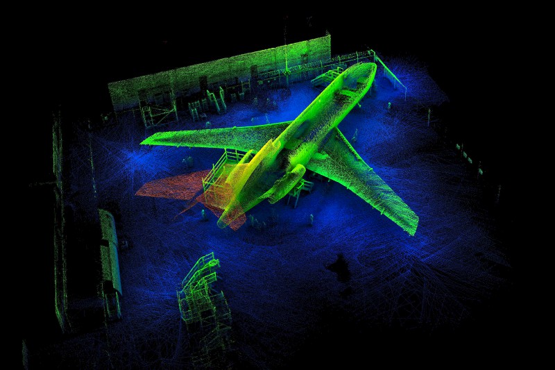
Zebedee 3D scan of the Aviation Australia Boeing 727 in Brisbane QLD.
Not the Batplane, but a 3D scan of a Boeing 727 at Aviation Australia in Brisbane.
Since 2010, Zebedee has been in action across the globe for a range of cool purposes, from preserving world heritage sites to exploring the complex interior of the Leaning Tower of Pisa.
But it’s never been used like this before.
For the first time, our real world crime fighters at the Queensland Police Service are using Zebedee to help piece together crime scene puzzles.
Crime scenes can be difficult to investigate. They’re often places like dense bushland, steep slopes or dangerous caves, which can make thorough sweeps of the scene both tough and time consuming. Using Zebedee, also known as ZEB1, police can now easily access these hard to reach places and map confined spaces where it may be difficult to set up bulky camera equipment and tripods. It also means less disturbance of the crime scene.
Using data collected by the scanner, police investigators can quickly recreate the scene on their computer in 3D, and view it from any angle they want. They can then locate and tag evidence to particular locations with pinpoint accuracy.
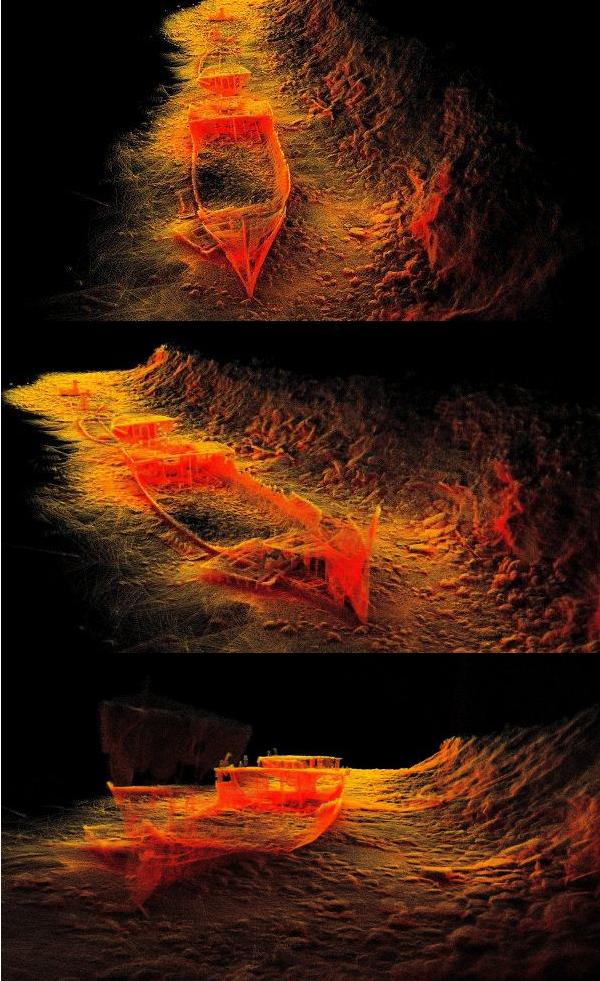
Zebedee scans of HMQS Gayundah at Woody Point, Queensland
Not the Batboat, but a 3D scan of the half-submerged HMQS Gayundah wreck. Zebedee helps make all angles accessible.
This Brisbane-born technology is now available commercially and this local application is a striking example of how 3D mapping can allow us to access locations and view angles previously out of our reach.
It will help our local detectives and crime fighters in the Police Service generate and pursue lines of enquiry for incidents like murder cases and car crashes. You could say that Zebedee puts the CSI in CSIRO.
We’re working on even more ways to adapt Zebedee for a range of other jobs that require 3D mapping, from security and emergency services to forestry and mining, even classroom learning.
Film makers may soon be able to use Zebedee technology to easily digitise actual locations and structures when creating animated worlds. Maybe the next Batcave we see at the movies will be more realistic than ever before, created by 3D mapping an actual cave.
The potential applications are endless.
