This virtual library will make exploring for critical metals more efficient and less impactful on the environment.
In Mario Kart, when you go down the pipes you can instantly get to another point. Imagine if you could do something like that for mining. But instead of getting to point B, you could find what you’re searching for faster, saving you time and money.
Like finding a needle in a haystack, one of the big challenges in exploring for lithium, copper – or any other critical metal – is in identifying sites to target. Once you have some confidence you are close, you sample the earth for further analysis.
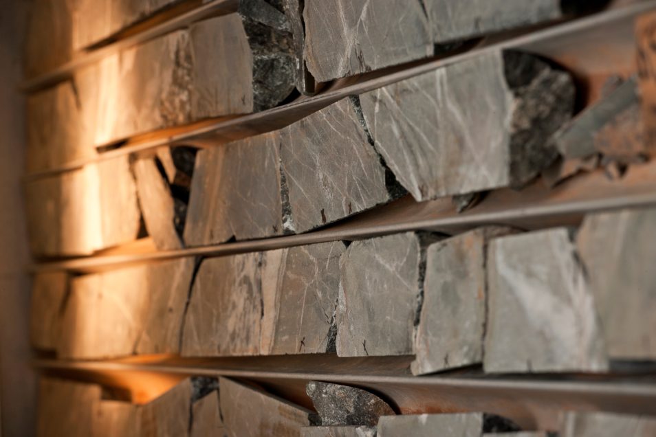
To do this, coffee‑cup-diameter tubes of rock known as ‘drillcore’ are extracted for geologists to study. This is done by drilling as deep as two kilometres beneath the surface.
Although drilling is an essential part of mineral exploration, it’s expensive and impactful on the environment. On top of that, each drillhole costs around $200 to $300 per metre of core. Multiply that by hundreds of metres and you’re talking potentially hundreds of thousands of dollars for one drillcore sample.
There are more than 10 million metres of drillcore estimated to be archived in warehouses around Australia. So it’s critical to make the most of the valuable information contained within them to help reduce the industry’s reliance on drilling.
Whenever, wherever: a virtual core library
The vision to digitise this collection and build a database of what’s beneath Australia’s landscape is being realised through AuScope’s National Virtual Core Library.
So how do you turn 10 million metres of core into a virtual library?
Key to building the library is a system we developed called the HyLogger. The machine looks like a cross between a giant photocopier and a sun‑bed, awaiting trays of core in rows placed on a robotic table for scanning. The platform moves while the infrared spectrometers above are static, sensing each row of rock as it moves in a neat pattern beneath it. Kind of like how a scanner or a photocopier would copy a piece of paper.
HyLogging works by identifying the minerals and textures contained in the rock. This data is then easily compared and mapped with other adjacent cores or rocks to build a bigger picture of what’s underground in a given area.
The HyLogger scans cores in about four minutes. It dramatically improves efficiency and productivity by providing ‘a new set of eyes’ to geologists, so they can map mineral composition rapidly and objectively. It then generates digital images, and mineral and surface profiles of the rock.
There are seven Hylogging machines in use by Australian state and territory geological surveys. The technology is now also licensed to Australian company Corescan.
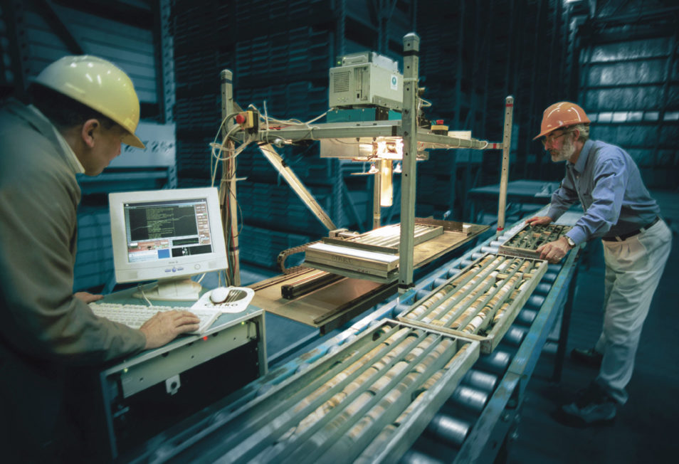
This HyLogger prototype has been developed so it’s driven by a robotic sampling system. This makes it largely automatic.
A wealth of info to help explorers hit the right target
Digitising core samples provide new results from scans and is adding to our body of knowledge about the underground and Australia’s mineralogy. But there are a wide range of benefits that come from this library.
This resource is crammed with valuable information to help explorers better target prospective areas. This reduces their reliance on drilling which, in turn, lessens impacts to the environment. It’s also providing them with new insights to better plan their exploration programs.
Australia’s state and territory geological surveys have been scanning old core from the archives, as well as new cores from industry. Over a million metres of drillcore have been scanned so far.
It is furthering government, research and industry understanding of orebodies and the complex mineral systems around them.
The National Virtual Core Library is an open-access resource for anyone in the world.

23rd September 2019 at 10:41 pm
Thank you for the information,
The GSWA – Perth and Kalgoorlie have been collecting core as part of the EIS Royalty for regions scheme for many years. I believe that they have “HiLogged” all submitted and photographed same. That excludes several tens or hundreds of kilometres actually drilled by mineral exploration geologists over the decades since the nickel boom. I for one, have taken careful photographs of the cleaned wet core, marked up with both geological units, mineralisation units and orientation lines (base of hole). This was true of all of my drilling whence I was at Kambalda, Western Areas exploration projects, Central Norseman Gold research projects and Neometals nickel sulphide exploration projects. This amounts to just on 50 years of nickel and gold exploration; dating from graduating from the Geology Department at ANU in 1970 up to my semi-completed retirement in 2018. All photography was lodged within the company database files of various styles over the years. This vastly outnumbers the few kilometres of core that I had lodged with the GSWA. It is almost required practice for ALL diamond drill core-logging geologists in the mining industry. No doubt there will be examples of lazy geologists who should have their degrees stripped off of them for failing to complete this task; but the greatest loss of hard core data (sic.) is attributable to jumped-up accountants/company directors who will throw away both core and photography to satisfy their misguided cost cutting aims. By the way, I was able to get extremely good drilling rates from start of hole up to final down hole surveying and other incidentals of just under $200 per metre for excellent NQ2 core, washed and emplaced in high quality plastic core trays. That is, an all-up cost! Most of drilling depths ranged from circa 200m to 1800m and most were in WA as well as a few holes near Oodnadatta, SA. I have actually retained photography on my home computer for the last 20 years. I may not be able to join the photos with the geology logs and with all analytical data as that is a major job for a student over the holidays, but there you go.
Finally, I trust that you will combine all visible photography, Hilogger imagery and any other geophysical logging with the geochemical data that was collected over zones of mineralisation and for research purposes. That would be a coup for you! I also recommend that the amount of drill core in WA will swamp the rest of Australia, as usual, in quantity and quality, so it is really a national project worthy of many geological organisations from academia and the cutting edge of mineral exploration.
Cheers to all & I hope to follow your progress in the future even though I am now a dole bludging pensioner due to my age and not having any further employment prospects.