Underneath the barren landscape of the Nullarbor Plains in South Australia lurks a mysterious magnetic anomaly which has intrigued geologists for decades. New data is helping to explain what is it and how it may have formed.
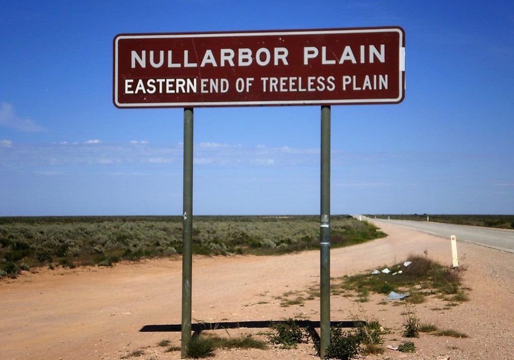 The Nullarbor in South Australia is a strange, geological marvel. In the 1970s, survey planes detected mysterious magnetic signals emanating from beneath the barren plains.
Stretching across the south-western corner of South Australia, this vast expanse where the Earth’s magnetic field is unexpectedly weak became known as the Coompana Anomaly. The Coompana Anomaly has intrigued geologists for decades, sparking speculation on the source of these unique signals.
One explanation for this phenomena may be that the rock was actually formed in the Northern Hemisphere and moved south on its tectonic travels.
Another explanation suggests the rock formed at a time when the Earth’s magnetic poles were reversed.
A third theory suggests its strange crater-like shape could be the result of an ancient meteorite impact. An interesting hypothesis considering this region is a favourite fossicking ground for meteorite hunters searching for more recent falls.
What these magnetic signals do suggest is the existence of a deep body of unusual magnetisation beneath the surface limestone and sand.
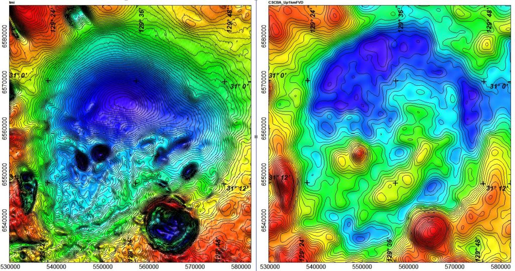
The main Coompana Magnetic Anomaly with surrounding satellite bodies (left the magnetic field, and right an enhancement of the gravity field).
But why would these rocks emit different magnetic signals from the surroundings?
Remanent magnetism
Remember the iron filings and magnet experiment at school? Well, just like those traces of iron filings lining up along the magnetic field coming from the magnet, iron particles within rocks are similarly affected by the Earth’s magnetic field.
When new igneous rock forms and cools, iron particle within the rock lock in the magnetic field present when it was first formed. This magnetic record is called remanent magnetism.
The Coompana Anomaly, one the largest remanent magnetic anomalies in the world, is due to the remanent magnetism of the deep igneous basement rock, which was formed at a different time to the surrounding rock.
Magnetic ‘pimples’
Further investigating the phenomenon, the South Australian Geological Survey recently completed a more detailed airborne survey of the area using remote sensing from a magnetometer just 80 metres above ground level on lines only 200 metres apart.
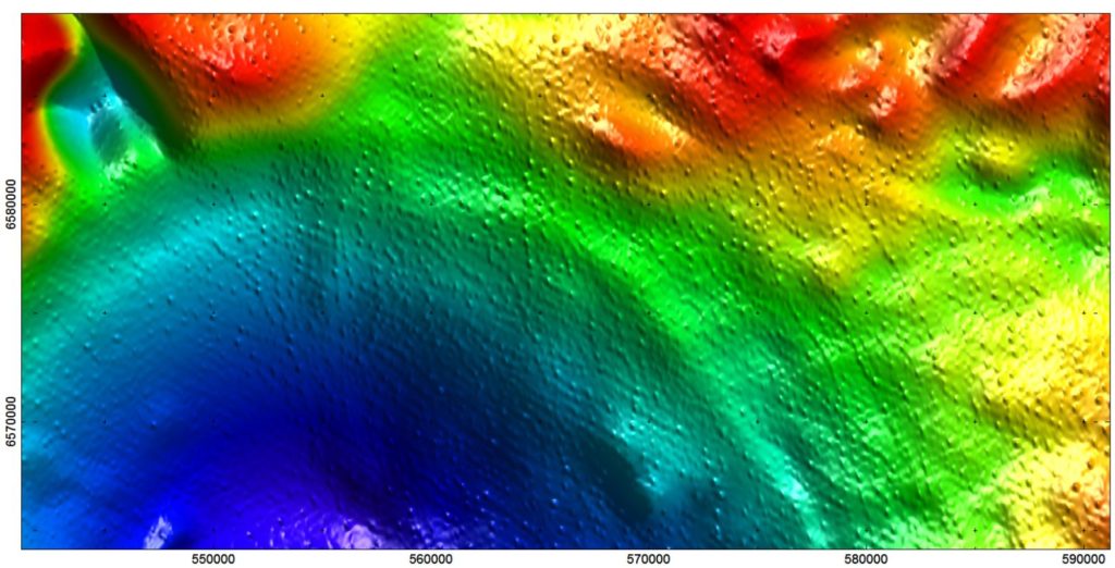
Magnetic field strength over the northern rim of the main Coompana Anomaly (blue for low to red for high) with some of the ‘pimples’.
Our scientists have been working closely with the South Australian Geological Survey to analyse these results and have revealed intriguing new details about magnetic signals just beneath the surface.
Small ‘pimples’ of anomalous magnetic signals were detected in shallow rock-structures dotted throughout the region surrounding the larger Coompana Anomaly.
Some researchers speculate these pimples may be the result of ancient paleo rivers or sinkholes which carved through the limestone surface and trapped magnetic grains washed or blown over the limestone surface.
Unlike the larger Coompana Anomaly which lies well over 200 metres below the surface, the magnetic sources for these anomalous pimples are just beneath the surface. There could be other heavy minerals associated with the magnetic grains causing these pimples, including commodities such as rare earth metals.
What we are learning from the magnetic data is only part of the story. We are continuing our partnership with the South Australian Geological Survey to understand the geological make-up and value of the region from convergent data sources, such a drill core analysis and other remote sensing technologies.
The Nullarbor area is a prospective site for copper, nickel and gold, yet the thick limestone cap hides surface features which could suggest what mineral riches may lie beneath.
This includes ongoing work with the Geological Survey of South Australia sampling vegetation for traces of minerals which may indicate the presence of prospective ore bodies below. We are also about to embark on a major soil sampling project to see if we can detect deep seated mineralisation through thick sedimentary cover.
This work was supported by the South Australian Government as part of the PACE Copper initiative for the state’s geological survey. This research also demonstrates our continuing contribution to the UNCOVER initiative, a collaboration of government, research institutes, universities and industry focused on finding and extracting the hidden wealth that lies beneath the top surface regolith.
Read more about exploration through cover.

6th August 2017 at 12:47 pm
Conspiracy theorists will love this one, “Its a spaceship from an ancient alien culture that crashed millions of years ago”
24th July 2017 at 12:28 pm
Shallow heavy mineral strand lines or lateritic gravels in drainages, and 200m sampling making them look pimply due to gridding artefacts?
The coincident magnetic ring structure and gravity high the south looks like a carbonatite diatreme, has this been drill tested?
22nd July 2017 at 9:14 am
Given the amount of mineral sand activity in the area (mining & exploration) the mineral filled karst idea for the pimples is a realistic possibility. I have seen this on a small scale in a Sri Lankan project.
14th July 2017 at 3:37 pm
Sounds like a good source of Nickle iron from a large meteorite. Does Clive Palmer know about this.
13th July 2017 at 4:48 pm
How do the “pimples” line up with the sample locations? They look a lot like a sampling artifact.
14th July 2017 at 3:36 pm
“Pimples” are, as you suggest, picked up on single flight lines (200m-400m line spacing in the EW direction), but are often found in distinct elongate trends at high angle to the flight lines.
Alignments of these pimples are seen in NNW-SSE, N-S and NW-SE orientations, and may be related to similarly oriented fracture sets in the basement rocks.