Here in Australia we have a wide range of fantastic continental scale systems for monitoring elements of our environment, from the climate, atmosphere, water and oceans, to earthquakes and tremors, and vegetation and land cover.
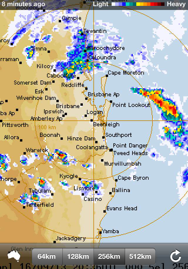
Bureau of Meteorology weather monitoring systems, such as their rainfall radar, aid decision-making – like knowing when it’s safe to take your hairdo outside.
Historically, these environmental domains have been well served. Most people would be familiar with the Bureau of Meteorology’s (BoM) weather and climate monitoring, for example.
(Their rainfall radars have saved my hairdo on more than one occasion)
Operated by the likes of BoM and Geoscience Australia, environmental monitoring systems have allowed the Australian Government to make informed continental-scale decisions, and they are also put to good use by countless others, not least our maritime, aviation and agriculture industries.
What we haven’t had on a continental scale though is consistent information about Australian biodiversity that can support national decision-making. There has been no system in place that spans the continent and can tell us how the diversity of species is changing over time and over geographic space.
To address this deficit, a collaboration of BoM, CSIRO and the Atlas of Living Australia have looked into how such a system might work and released their findings in a new report‑ Biodiversity Profiling: Components of a continental biodiversity information capability.
Importantly, they found that it would be possible to put a biodiversity assessment system in place using existing capability, such as data stores, environmental modelling tools and spatial information.
The team found that the Atlas of Living Australia, an online database of Australian biodiversity that has brought information from our natural history collections, state and territory conservation agencies, biodiversity interest groups and individuals, together with related environmental and mapping data, provides a unique opportunity to establish a continental-scale biodiversity assessment system.
An applied case study in the report shows that data contained within the Atlas can be combined with environmental data to derive models of biodiversity patterns, which can then be combined with satellite imagery, such as that acquired by the National Carbon Accounting System, to infer patterns of biodiversity loss or retention in individual regions. The authors say this demonstrates the potential for data and models to be linked for continent-wide monitoring.
Further development of the Atlas and the Terrestrial Ecosystem Research Network, which champion consistent ecological research, monitoring and data sharing across the continent, are rapidly improving our nation’s ability to monitor the landscape.
By integrating data collection and modelling capabilities with the monitoring systems of BoM, Geoscience Australia and other government agencies, there will be new opportunities to understand ecological change and support the Australian Government’s continental-scale decision-making.

An indication of the spatial data held by the Atlas of Living Australia. This map is a snapshot in time showing the occurrence density of biological records on the Atlas.

19th September 2013 at 4:10 pm
I’ve been contributing to, and using ALA, BOM, BowerBird, GA, State fire maps, etc. for several years and have often wondered what marvellous insights could be gained by combining all that data… I think we’ve hardly scratched the surface. (ALA in particular is a very underrated resource). Thanks.