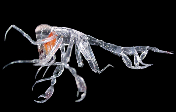
One of the many animals collected from the Bight’s deep water column, the unusual amphipod (genus Phronima) – a type of crustacean.
One of the many animals collected from the Bight’s deep water column, the unusual amphipod (genus Phronima) – a type of crustacean.
At the surface, it is home to white sharks, southern bluefin tuna, and marine mammals including blue whales and sealions – the images that make the Great Australian Bight a vast and iconic Australian ocean region.
Down deep there’s another lesser known world – and a frontier area for marine science, plus oil and gas exploration. Although we know that more than 85 per cent of shallow Bight species (such as those mentioned above) can be found nowhere else in the world, very little is known about their deep water counterparts.
We recently returned from 20 days exploring deep waters of the Bight – the first voyage supporting our recently announced science collaboration with BP and Marine Innovation Southern Australia (MISA, a consortium of South Australia’s major marine research institutions, including the South Australian Research and Development Institute, University of Adelaide, Flinders University and the South Australian Museum); a collaboration aimed at gaining a greater scientific understanding of the Bight.
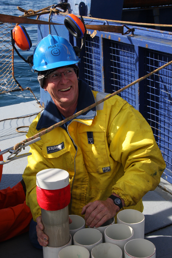
In the video below meet CSIRO’s Mark Lewis and see our research in action.
In one of only a few whole-of-ecosystem studies undertaken in Australia, CSIRO and MISA are providing information to decision makers in industry and government to support sustainable development in the Bight and monitor possible future impacts.
Aboard Australia’s Marine National Facility research vessel, the Southern Surveyor (check out a virtual tour of the ship), we surveyed the Bight in depths of 200 to 2000 metres – collecting the deepest set of samples ever taken from the area.
Using a range of equipment, we collected samples of fauna from the seabed and the water column such as fishes, crustaceans (shrimp and crabs) and echinoderms (sea stars, sea urchins and sea cucumbers) and phytoplankton (single-celled plants). These included unusual species like the bizarre amphipod Phronima (see picture above) and this deep sea crab (below).
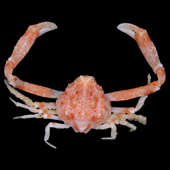
One of the many animals collected from the Bight’s deep seabed, we think it could be a new species but we’re checking (it is similar to Ebalia tuberculosa).
One of the many animals collected from the Bight’s deep seabed, we think it could be a new species but we’re checking (it is similar to Ebalia tuberculosa).
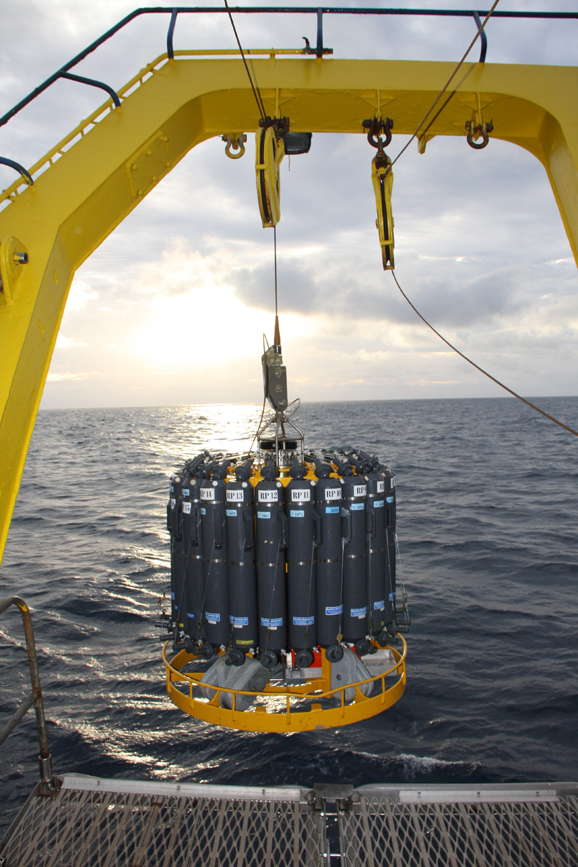
We also collected a great variety of environmental information, including acoustic data that will help map the seabed and determine if oil seeps are present. We used what’s called an integrated coring platform (ICP), pictured below, which collects sediment cores from the seabed plus acoustic measurements (we recently blogged about this piece of gear).

Matt Sherlock with the Integrated Coring Platform (ICP). This instrument is lowered to the seafloor, where it collects a set of six sediment cores, along with a water sample. On the way down, and the way back up, it also collects information on the presence of hydrocarbons, and sends out an acoustic signal (much like that of a depth sounder on a boat) to measure fish and plankton presence.
CSIRO electrical engineer, Matt Sherlock with the Integrated Coring Platform (ICP). This instrument is lowered to the seafloor, where it collects a set of six sediment cores, along with a water sample. On the way down, and the way back up, it also collects information on the presence of hydrocarbons, and sends out an acoustic signal (much like that of a depth sounder on a boat) to measure fish and plankton presence.
There is a reason that we’re collecting all of these wonderful critters, samples and data – it will help us understand the composition, distribution and number of species in the Bight, and the ways in which they are influenced by the environment around them. This will be vital information for any potential development in the Bight.
All of this information contributes to an ecosystem model, which will help CSIRO, MISA and BP understand how the ecosystem could change with, for example, future development or exploration (for oil and gas for example), allowing industry and government to plan for future activities in the region in an informed way.
Survey results will be made available to decision makers in industry and government – to help evaluate the needs for future ecological monitoring as oil and gas activities accelerate and expand in Australia’s deep ocean.
Read more about our Great Australian Bight collaboration with BP and MISA.
Mark Green with a recently collected sediment core from the GAB, which will be used to assess the fauna present in the sediments, and be examined for the presence of any naturally occurring hydrocarbons.
CSIRO ecologist, Mark Green with a recently collected sediment core from the Bight, which will be used to assess the fauna present in the sediments. These are some of the deepest samples ever collected from the Great Australian Bight.
CTD (conductivity, temperature, depth sensor) with niskin bottles for collecting water samples being deployed at dawn. The instrument is lowered to just above the seabed, recording data on salinity, temperature, oxygen levels, and fluorescence (an indicator of phytoplankton presence) all the way. Niskin bottles are then fired at specified depths on the way up to collect water samples for detailed analysis of hydrocarbons, phytoplankton and nutrients.
Last but not least – another amazing piece of gear – the conductivity, temperature, depth sensor (CTD) with niskin bottles (water sampling bottles) for collecting water samples. The instrument is lowered to just above the seabed, recording data on salinity, temperature, oxygen levels, and fluorescence (an indicator of phytoplankton presence) all the way. Niskin bottles are then fired at specified depths on the way up to collect water samples for detailed analysis of hydrocarbons, phytoplankton and nutrients.

22nd May 2021 at 11:15 am
Very cool! Thanks for the video.