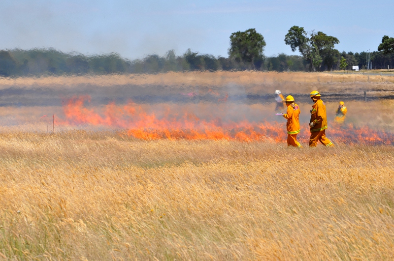
CSIRO and CFA experimental grassfire burns, Ballarat, January 2014.
We’re keeping a close eye on grassfires this summer.
This week’s heatwave across southern Australia has reminded us of the serious dangers posed by grassfires. They might not sound that threatening, but these fires can travel at speeds of up to 25 kilometres per hour, and damage hundreds of hectares of land within a matter of hours.
So while many of us were enjoying our summer holidays, our team of fire scientists were hard at work with researchers and volunteers from Victoria’s Country Fire Authority (CFA) to help learn more about grassfire behaviour in Australia.
In a series of carefully designed, planned and monitored experiments, the research team lit controlled fires in grass fields near Ballarat, an hour west of Melbourne.
The aim was to safely gather new and thorough data about grassfire behaviour in different conditions. Experimental plots containing grasses at different stages of their life cycle were burned, while experts observed and various instruments measured things like the time it took for the fire to burn across the 40 x 40 metre plot.
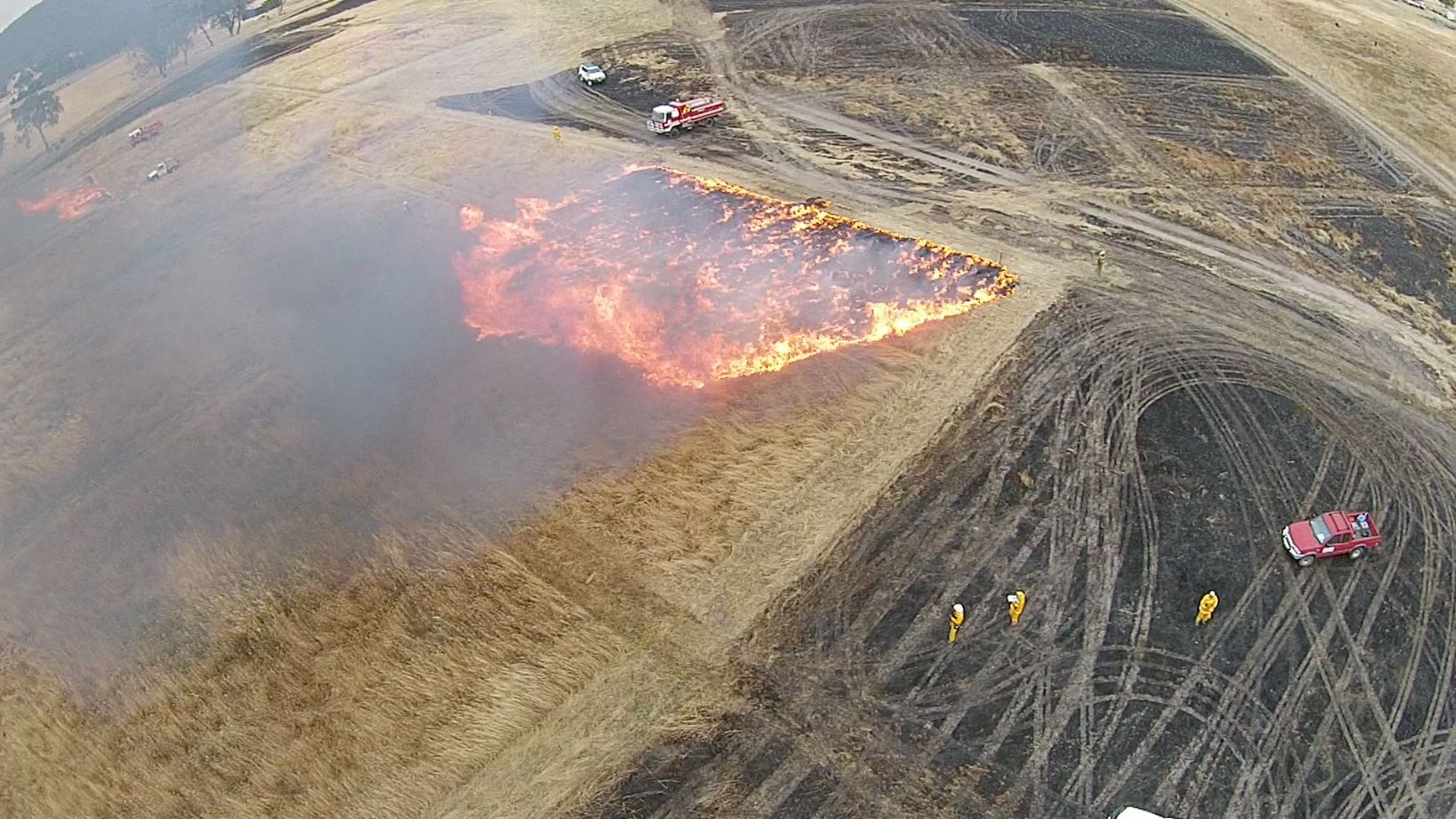
CSIRO and CFA experimental grassfire burns, UAV vision, December 2013.
The view of our grassfire experiment captured by an unmanned aerial vehicle.
Australian researchers have been looking into forest fires and bush fires for decades, but this is the first time in nearly 30 years since we’ve conducted research into grassfires.
Back in 1986 we ran similar experiments in the Northern Territory, which led to the development of our Grassland Fire Spread Meter. This tool is used by rural fire authorities across the country to predict the rate that a grassfire is likely to spread once it starts.
What remains unknown is at what stage of the grass’s life cycle it becomes a fire hazard, especially for the grass types found across southern Australia.
Today, we have technology like unmanned aerial vehicles (UAVs) to help gain a new, bird’s eye perspective of the fire’s progress, allowing us to analyse the burns with a whole new level of detail.

CSIRO and CFA experimental grassfire burns, UAV capture, December 2013
Send in the drones: our quadcopter UAV examines the experimental grassland burns near Ballarat.
Controlled by our scientists, the robot quadcopters flew above the experimental burns, filming the fire as it spread through the grass. The vision, along with other data captured by thermal sensors, will be used to develop computer models that can replicate and predict grassfire behaviour.
The results will help fire authorities like the CFA better respond to grassfires, as well as improving how they determine Fire Danger Ratings and when to declare Fire Danger Periods in particular regions.
The timing of the experimental burns was critical. The crew waited until the weeks of late December and early January for safe temperature and wind conditions to ensure any fires they lit would be easy to control and contain. They also needed the grass curing levels to be at the right amount. Thankfully, this was all wrapped up before we, and the grasslands, were hot and bothered by the heatwave.
Check out this video for the how and why of the experimental burns:

18th January 2014 at 5:17 pm
Excellent, My company Analysis & Technology australia has developed a program which would allow the pictures to be viewed real time on a map,along with GPS, the ability to markin fire lines,equipment location, and even connection to a data base of people in the area with their mobile phone number, so they can be contacted and warned. It is a situaltional awarnes package. No one bothered to respond even after many demonstrations. Perhaps CSIRO would like to save many hours work and get on board. If so please contact me.
20th January 2014 at 8:49 am
Hi Alan, I’ll pass your comment along to the relevant researchers.
Please be aware that this application of UAVs – to capture vision of fire progress – is only for research purposes during controlled experiments. We are not deploying them during fire emergencies. We do have research projects that are developing tools for Emergency Situation Awareness and have established a working group with a number of agencies and companies to draw up a roadmap for ESA technology and systems, but the operational use of UAVs to capture real-time vision is more a matter for the relevant fire and emergency authorities, such as the CFA. A number of logistical and regulatory barriers will need to be addressed before it can become a reality.